Measured Building Surveys · Glasgow
Measured building surveys
in Glasgow.
Accurate existing drawings of Glasgow buildings — floor plans, elevations and sections — drawn in CAD from a LiDAR scan and delivered in DWG and PDF. We are based in the city, led by a Chartered Architectural Technologist, and on site across Glasgow every week.
At a Glance
- Capture
- Leica RTC360 laser scanner
- 3D point accuracy 1.9 mm at 10 m (manufacturer spec), plus Matterport Pro3 and drone
- Drawings
- 1:50 or 1:100
- Plans, elevations, sections, roof and site plans, GIA/NIA areas
- Formats
- DWG + PDF
- To your layer standard and title block; point cloud as E57 / RCP
- Site visit
- Within the week in Glasgow
- Most flats and houses captured in half a day
- Delivery
- 1–2 weeks
- From the site visit, depending on building size and drawing set
- Quote
- Fixed price, same day
- Agreed before we attend site — no day-rate surprises
- Drawn by
- Chartered Architectural Technologist
- MCIAT — someone who prepares planning and warrant drawings
- Cover
- Fully insured
- Cover details available on request
Glasgow Buildings
Drawn as they are, not as the old plans say.
Glasgow's building stock does not lend itself to a tape measure. Sandstone tenements with bay windows and split-level closes, Victorian villas that have been extended three times, warehouses in the Merchant City with floors that fall by inches across a bay, civic buildings whose archive drawings pre-date the last two refurbishments. A laser scan records all of it in one visit — every wall, opening, level change and roof line — and the drawings are taken straight from that record.
The result is a base drawing your design actually has to deal with: the out-of-square walls, the step in the hallway, the true ceiling heights. That is the single best defence against on-site surprises, redesign fees and delayed warrants.
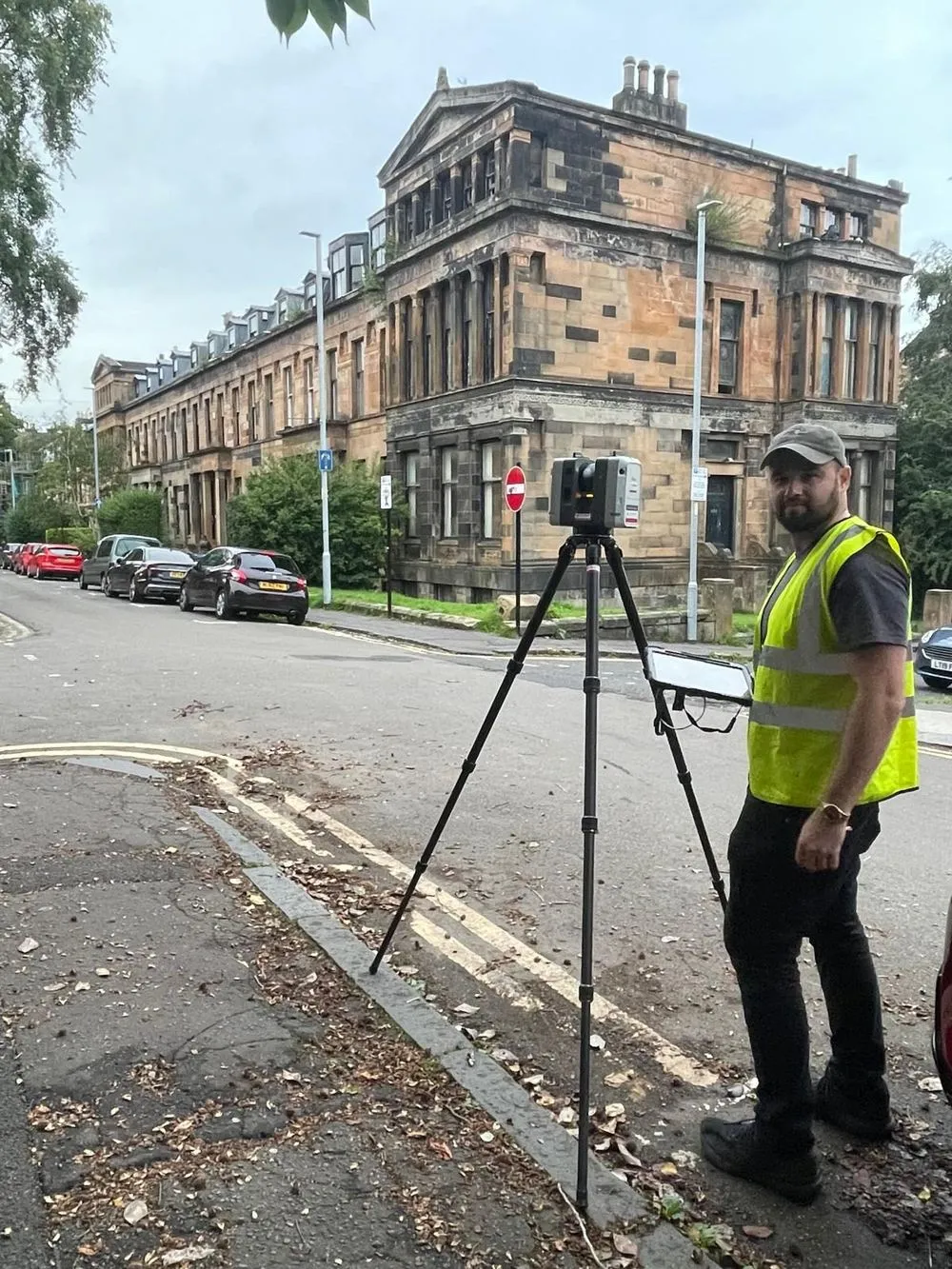
One scan, the whole building
Interior, exterior, roof and common areas captured in a single visit — no return trips to check a dimension.
Drawn by a designer
MCIAT-led. We know what a usable base drawing looks like because we design from them.
Your CAD standard
Layering, title block and template to match your practice, in DWG and PDF.
Fixed price, quoted fast
Address and scope in, price and programme back — usually the same working day.
What Glasgow Projects Use Them For
From a tenement flat to a concert hall.
Tenement flats & closes
Existing plans and sections of red and blond sandstone tenements — bay windows, box rooms, press cupboards, the lot — before a reconfiguration, extension or subdivision goes to Glasgow City Council for planning and a building warrant.
Villas & terraces in the West End and Southside
Accurate existing drawings of Victorian and Edwardian houses in Hyndland, Dowanhill, Pollokshields, Newlands and Bearsden — roof structure, level changes and out-of-square walls included — so extensions and loft conversions are designed to the building as it stands.
Listed buildings & conservation areas
Measured drawings of historic fabric for listed building consent and conservation area applications, captured non-invasively by scanner. Detail to suit Historic Environment Scotland and the planning authority.
Commercial conversions
Floor plans, elevations and sections of Merchant City warehouses, city-centre offices and retail units ahead of change-of-use, fit-out or residential conversion — with GIA/NIA areas where you need them.
Civic, cultural & education estates
Drawing sets for venues, schools and public buildings where the archive drawings are decades old. We have scanned the Glasgow Royal Concert Hall and the City Halls for exactly this reason.
Housing association & portfolio stock
Consistent, repeatable drawing sets across multiple blocks and estates for retrofit programmes, fire-safety works and asset records — one specification, one standard, every building.
How It Works
Scan. Draw. Deliver.
A complete 2D CAD set: floor plans of every level, external elevations, cross and long sections, and — where the project needs them — reflected ceiling plans, roof plans, site plans and GIA/NIA areas. See the full deliverables list.
Scan
A single site visit with terrestrial and mobile LiDAR. Most Glasgow flats and houses are captured in half a day; larger commercial and civic buildings in one to two days, with out-of-hours capture available for venues and occupied buildings.
Draw
We draw the building up in CAD from the registered point cloud — floor plans, elevations and sections at 1:50 or 1:100, to your layering standard and title block, with door, window and level annotation.
Deliver
A coordinated drawing set in DWG and PDF, usually within one to two weeks of the scan, plus the point cloud on request — viewable and measurable in your browser through the Kanna client portal.
Sample Drawings
What you actually receive.
Issued sheets from a recent survey of a four-storey Victorian townhouse in Glasgow's West End — drawn at 1:50 from a Leica RTC360 laser scan, Matterport interior capture and a drone roof survey, and delivered in DWG and PDF. Title blocks removed; click any sheet to open it full size.
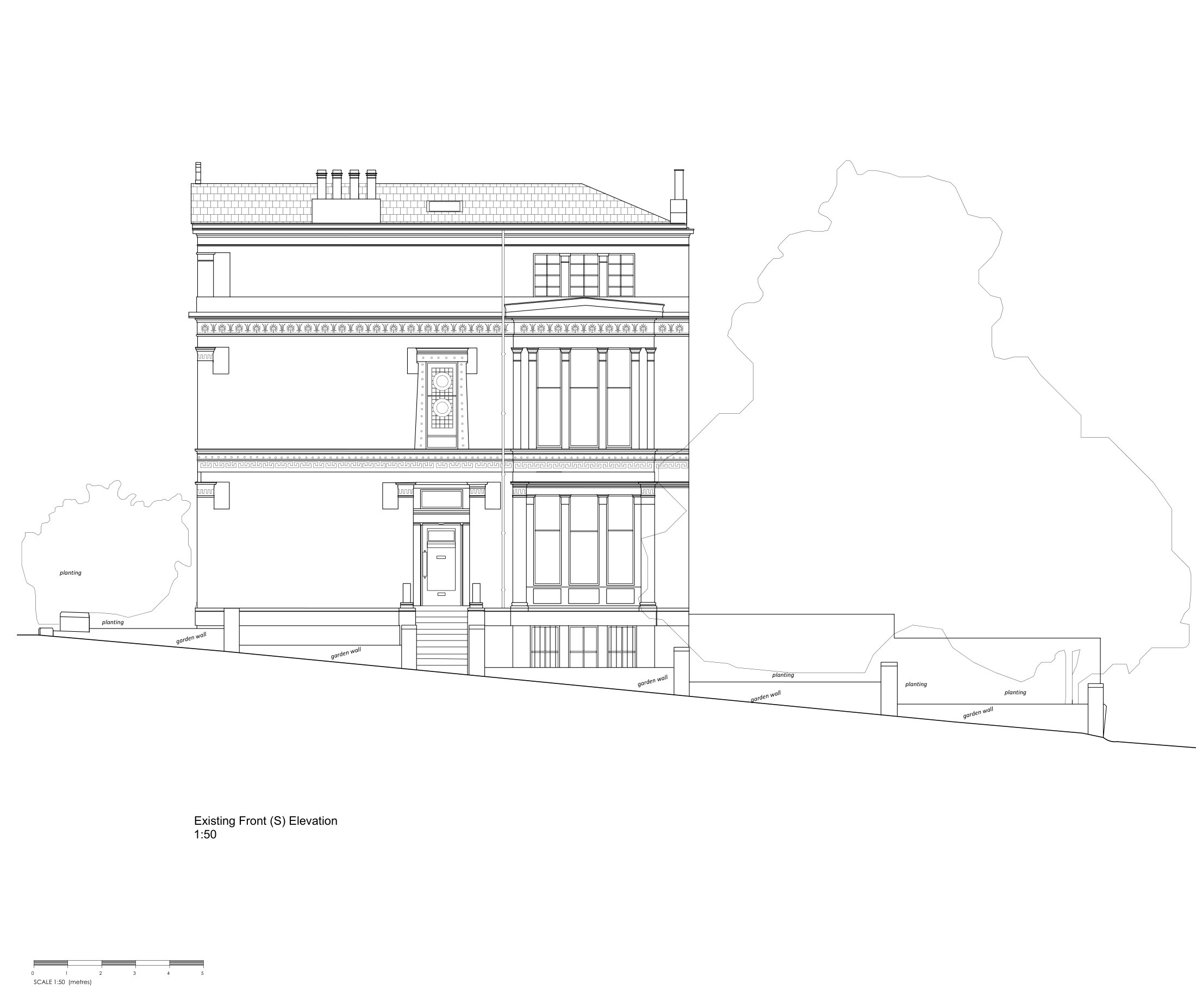
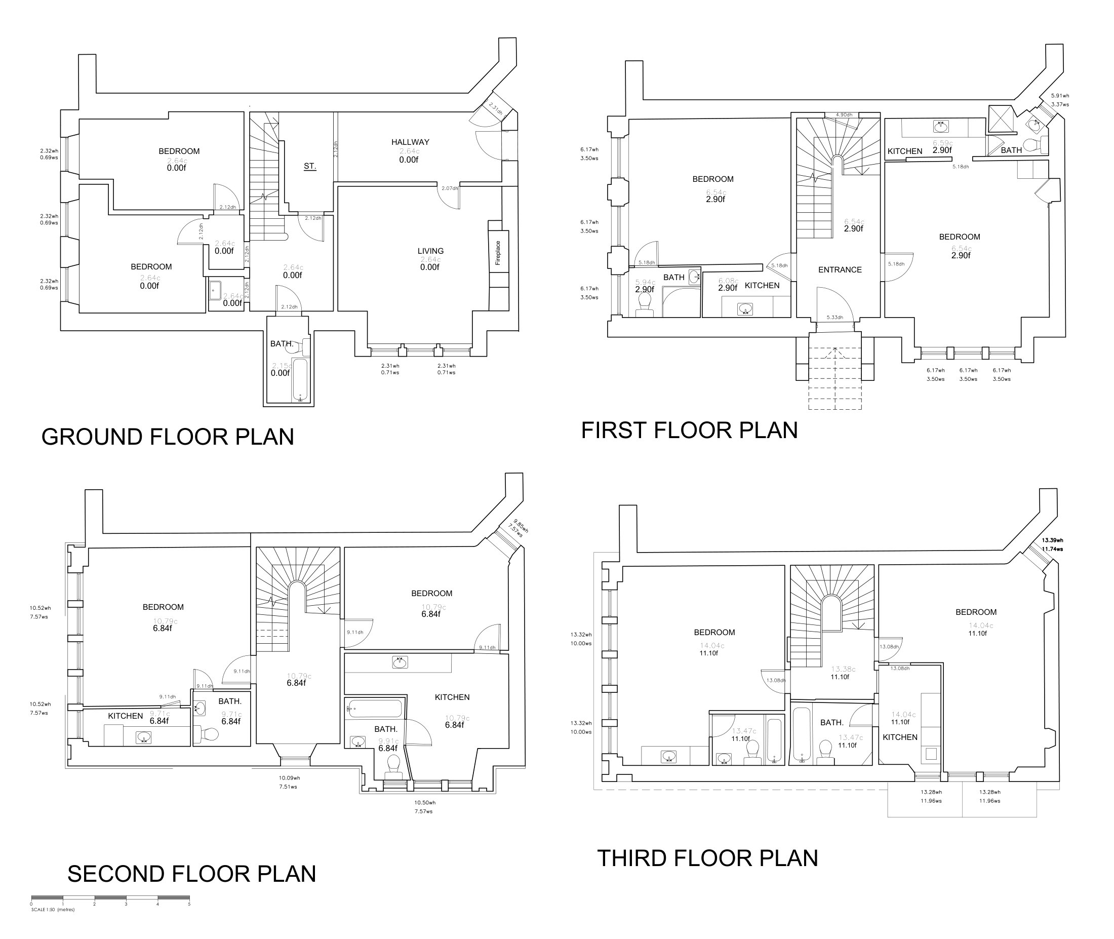
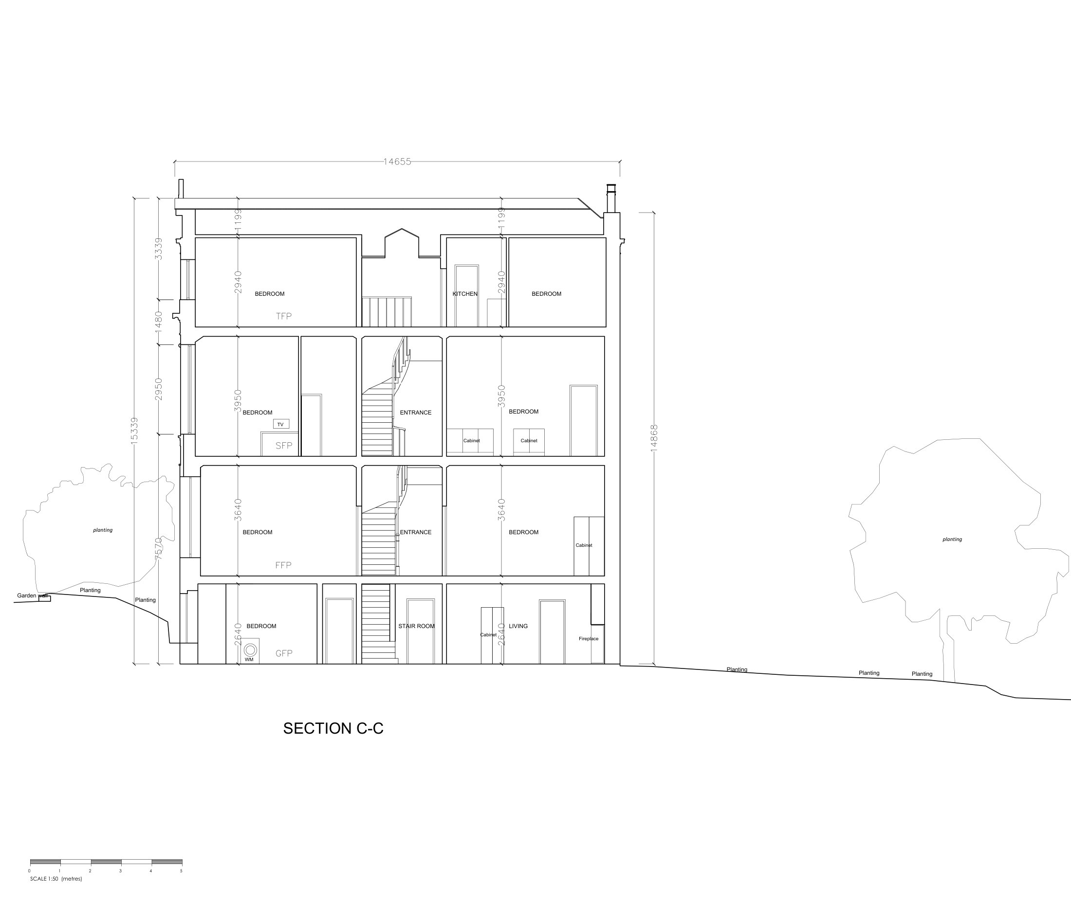
Download the full sample drawing pack (PDF, 10 pages, 1.9 MB) · See the full nine-sheet set and the scan it came from: Victorian townhouse, Glasgow West End →
Measured Surveys in Glasgow
Cost, accuracy and turnaround.
How much does a measured survey cost in Glasgow?
Every survey is a fixed price agreed before we attend, set by the size of the building, access and the drawings you need. Most Glasgow flats and houses are quoted the same working day from the address and a short brief.
Measured survey costs in Scotland, explained →How accurate is a measured survey?
The drawings are taken from a registered laser scan — Leica RTC360, rated at 1.9 mm 3D point accuracy at 10 m — so they carry the building's real geometry: out-of-square rooms, true ceiling heights, level changes. Tolerance is agreed with you at quote stage to suit the scale and purpose.
How the laser scan is captured →How quickly can you survey in Glasgow?
Site visits are usually available within the week, and drawings follow one to two weeks after the scan. Drawings are prepared to the standard Glasgow City Council expects for planning and building warrant applications.
Existing drawings for planning and warrants →Glasgow Projects
Buildings we have already captured in the city.
Victorian Townhouse, Hillhead
Laser-scanned measured building survey of a four-storey West End villa — nine sheets at 1:50, plans, elevations and sections, issued within two weeks of the site visit.
Read the case study →Glasgow Royal Concert Hall
Matterport and point cloud capture of one of Scotland’s busiest venues, feeding Collective Architecture’s Revit model for renovation works.
Read the case study →Glasgow City Halls
UAV photogrammetric point cloud of the City Halls complex — roofscape and elevations recorded without scaffold.
Read the case study →Coverage
Across Glasgow
and the wider city region.
Being based in the city means same-week site visits without travel charges across Glasgow, and quick turnaround for the surrounding towns. We also survey across the rest of Scotland — see our Edinburgh measured building surveys — and travel UK-wide for larger instructions.
Quick Quote
Get a fixed price — usually the same working day.
Send the address and the drawings you need. No call needed; we come back with a price and a survey date.
Prefer to talk? 0141 260 0115
FAQ
Measured surveys in Glasgow, answered.
How quickly can you survey a building in Glasgow? +
What does a measured building survey in Glasgow cost? +
Are the drawings suitable for a Glasgow City Council planning application or building warrant? +
Can you survey tenement flats, closes and flats above shops? +
Do you survey listed buildings and properties in conservation areas? +
Do I get the point cloud as well as the drawings? +
Who carries out the survey and draws it up? +
Can I see an example of the drawings? +
Related Services
Explore more of what we do.
Point Cloud & LiDAR Surveys
3D laser scanning from terrestrial, mobile, and UAV LiDAR
Learn more →Scan-to-BIM
LiDAR point clouds converted to Revit models at LOD 200–400
Learn more →Matterport Surveys
3D virtual tours, floor plans, and point clouds from one visit
Learn more →Drone Surveys
CAA-authorised aerial photogrammetry and thermography
Learn more →Building Performance
Airtightness testing, thermal imaging, and U-values
Learn more →Digital Twins
Navigable 3D replicas of buildings and sites
Learn more →Film, TV & Games
Set, location, and asset scanning for production pipelines
Learn more →Need existing drawings of a Glasgow building?
Send us the address and what the drawings are for — plans, elevations, sections — and we'll come back with a fixed price and a survey date.