Digital Capture
Glasgow City Halls — Drone Point Cloud Survey
The Building
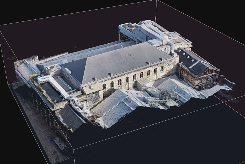
The City Halls on Candleriggs is one of Glasgow’s oldest performance venues, at the heart of the Merchant City. Its roofscape is a complex patchwork of pitched slate roofs, flat-roofed plant decks, ventilation equipment, and parapets — the kind of terrain that is slow, expensive, and risky to inspect by traditional access.
What We Did
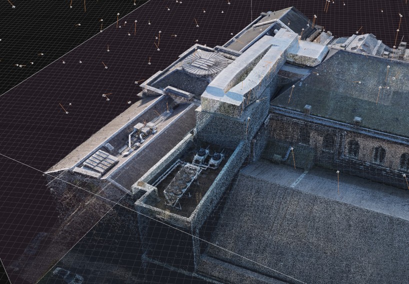
We flew a UAV photogrammetric survey over the complex, capturing overlapping high-resolution imagery across every roof plane and elevation. The imagery was processed into a dense, colourised point cloud of the entire complex — every chimney, plant enclosure, and parapet measurable from a desk.
The camera positions visible in the processed data show the systematic flight coverage: this is a planned survey product, not a fly-past with photos.
The Deliverables
- A dense colourised point cloud of the full complex, roofs and façades
- High-resolution source imagery of every roof plane
- Measurable record of rooftop plant and access arrangements
For a listed-environment venue in continuous use, drone capture answers the questions — roof condition, plant locations, parapet details, access planning — without scaffolding, MEWPs, or closing anything down.
Have a similar project?
Let's discuss how we can help capture or assess your building.