Digital Capture
Victorian Townhouse, Glasgow West End — Measured Building Survey
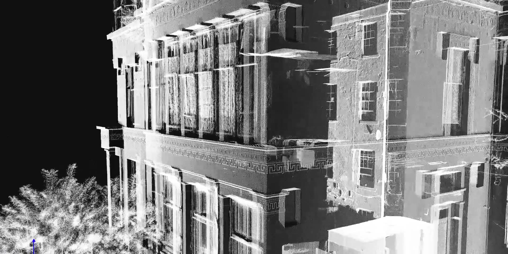
Watch the Data
The Building
A four-storey Victorian sandstone villa in Hillhead, a few streets from the University of Glasgow — classical doorway, canted bays, Greek-key and anthemion friezes, and a garden that falls steadily along the street. Like many of its neighbours it has been divided into flats, one or two per floor, with the original stair at its centre.
The project architects needed an accurate set of existing drawings as the base for their proposals. The archive drawings were, as usual, decades out of date.
What We Did
We captured the building with three methods in a single visit and drew it up from the data:
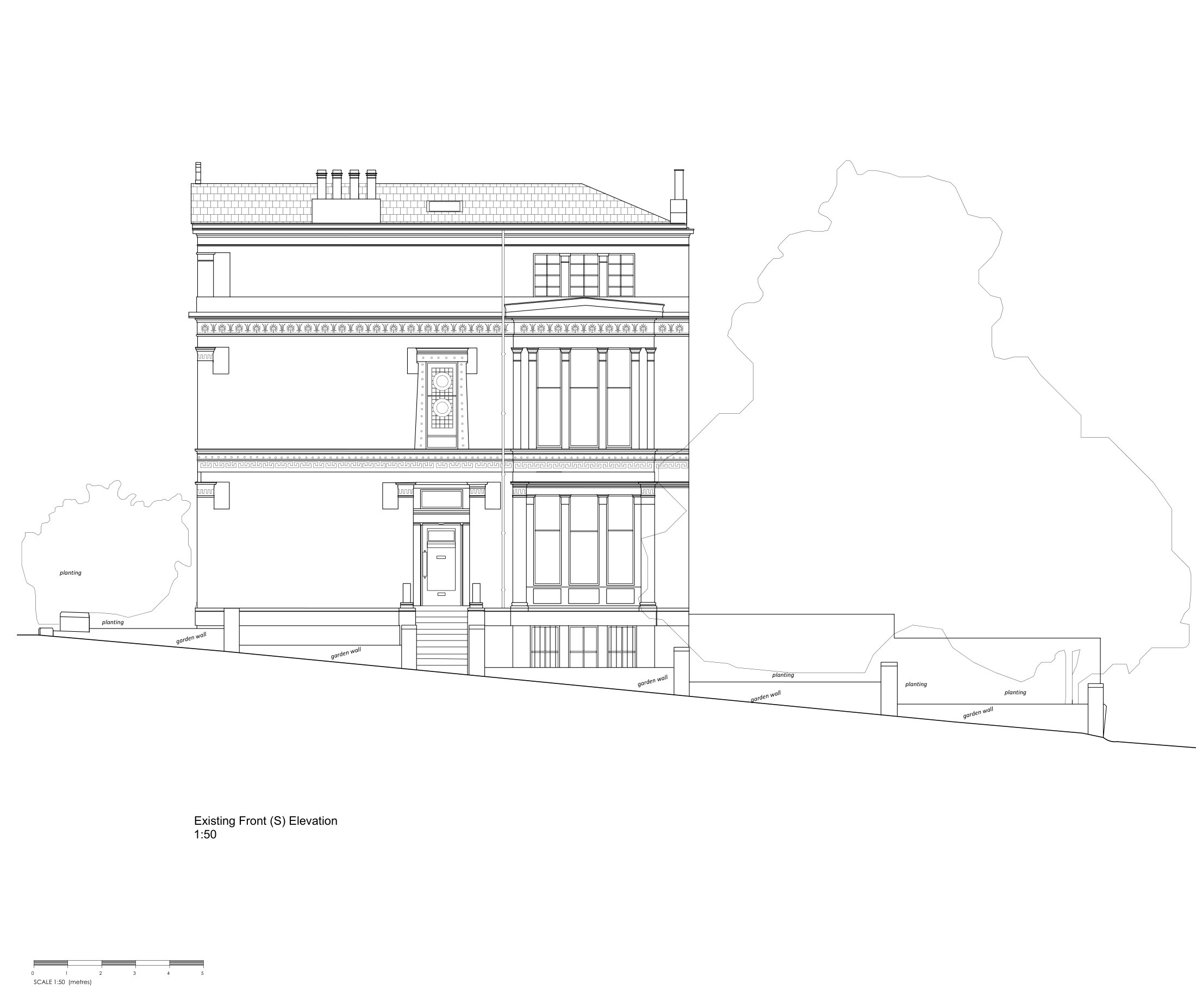
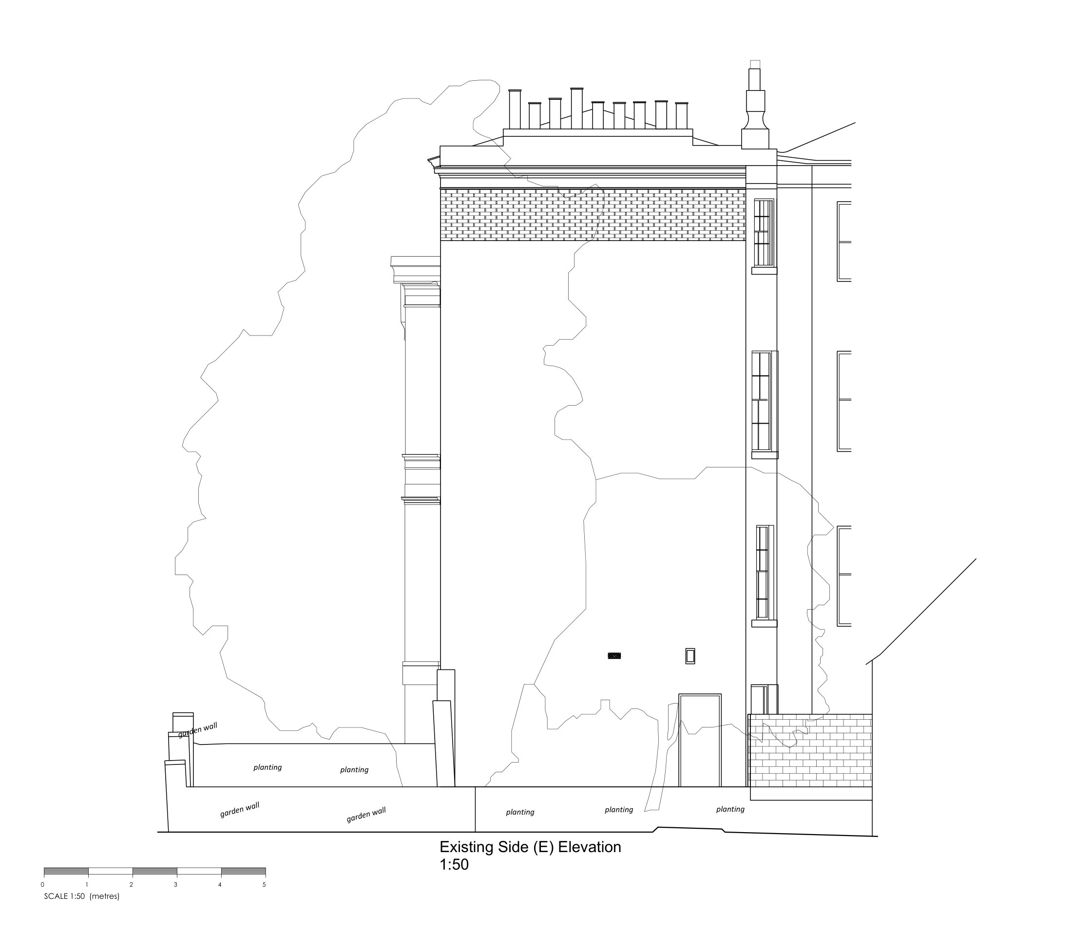
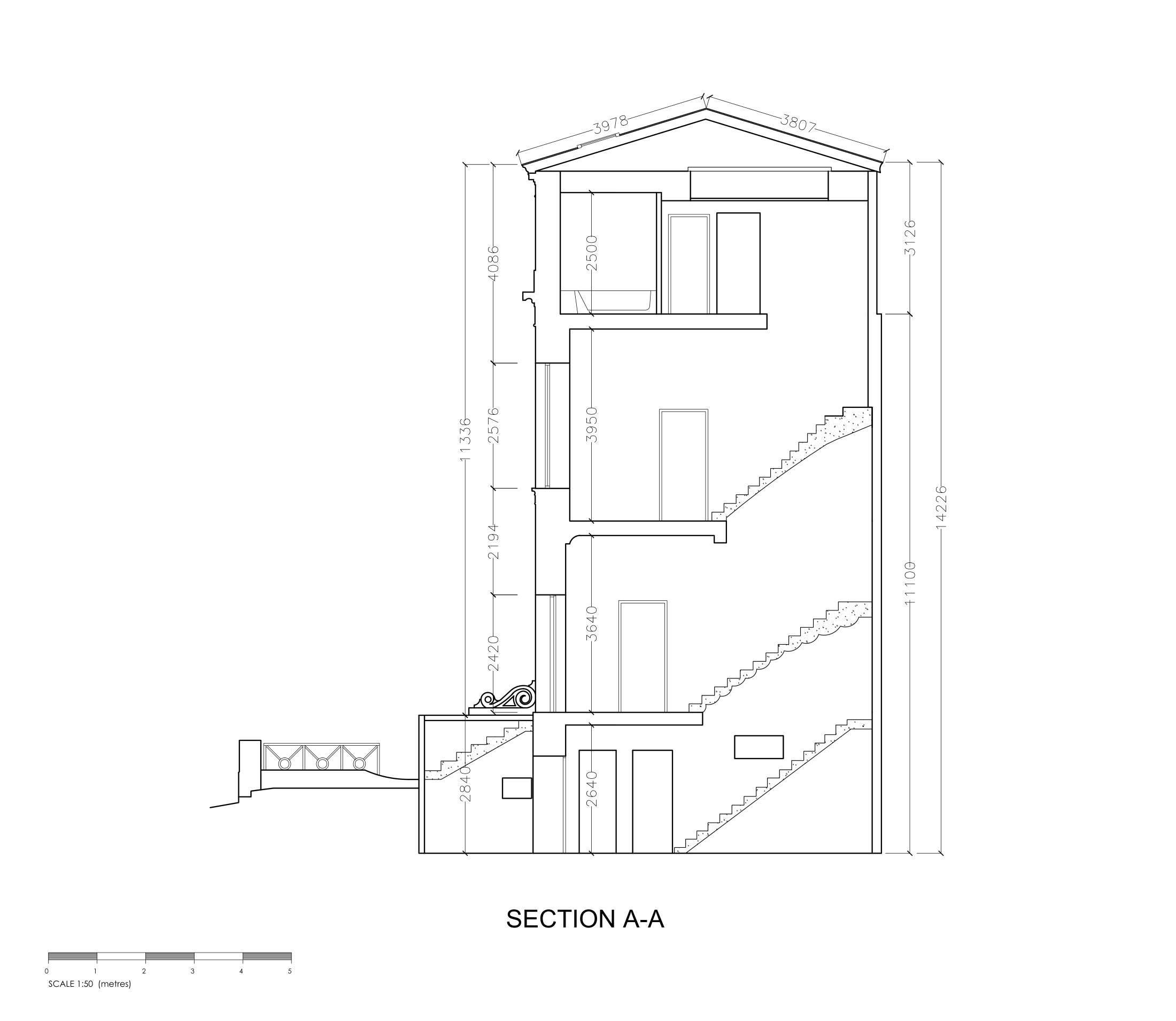
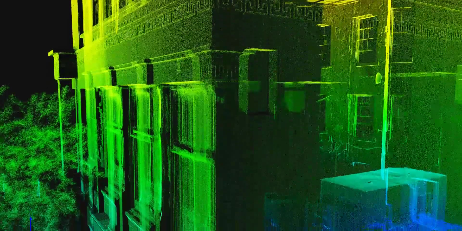
- Terrestrial laser scanning of the exterior with a Leica RTC360, giving a dense, registered point cloud of every elevation — the source for the elevations, the external envelope on the plans, and the sections.
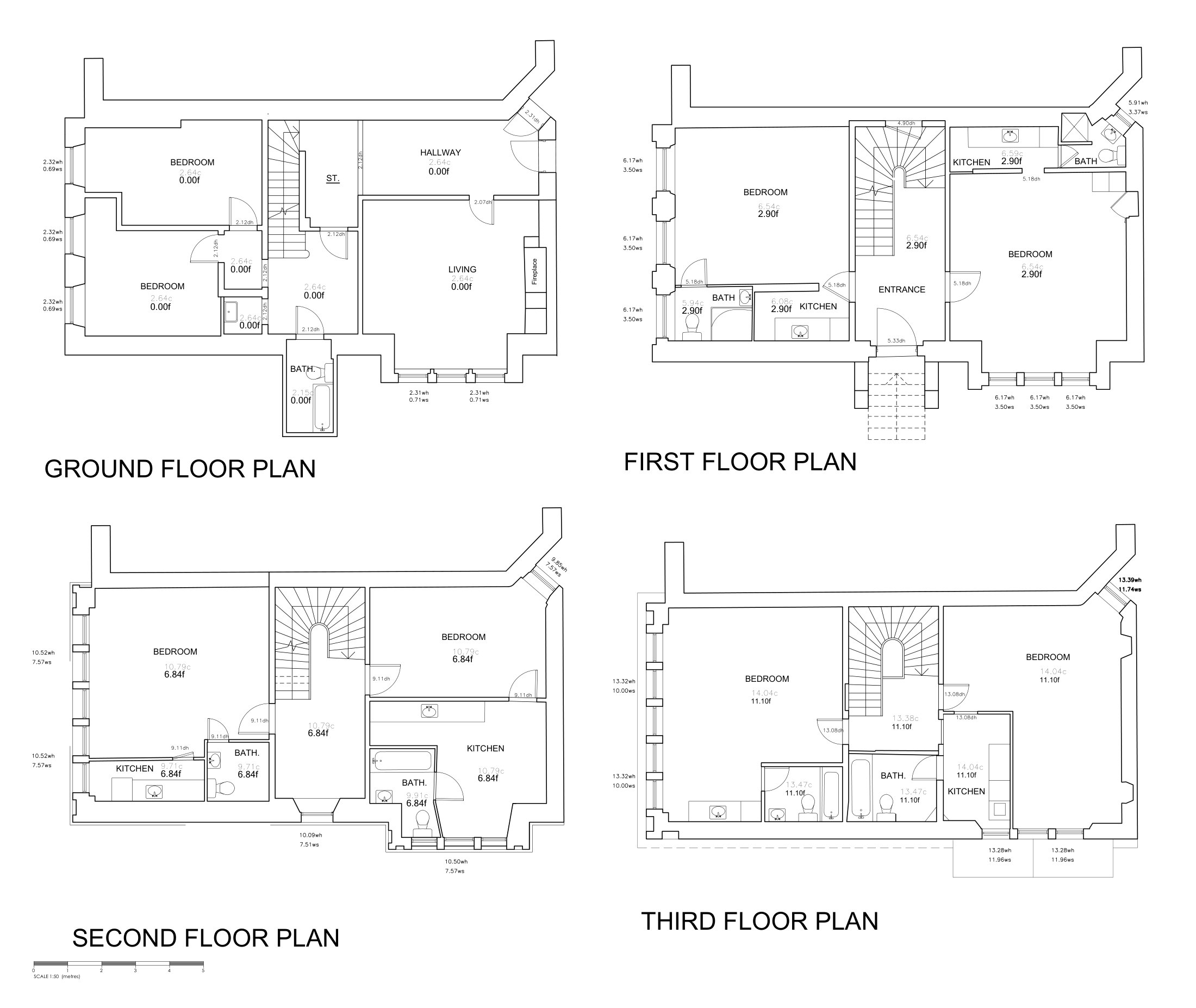
- Matterport Pro3 capture of the internal rooms on all four floors, used to draw the internal layouts, openings and fixtures.
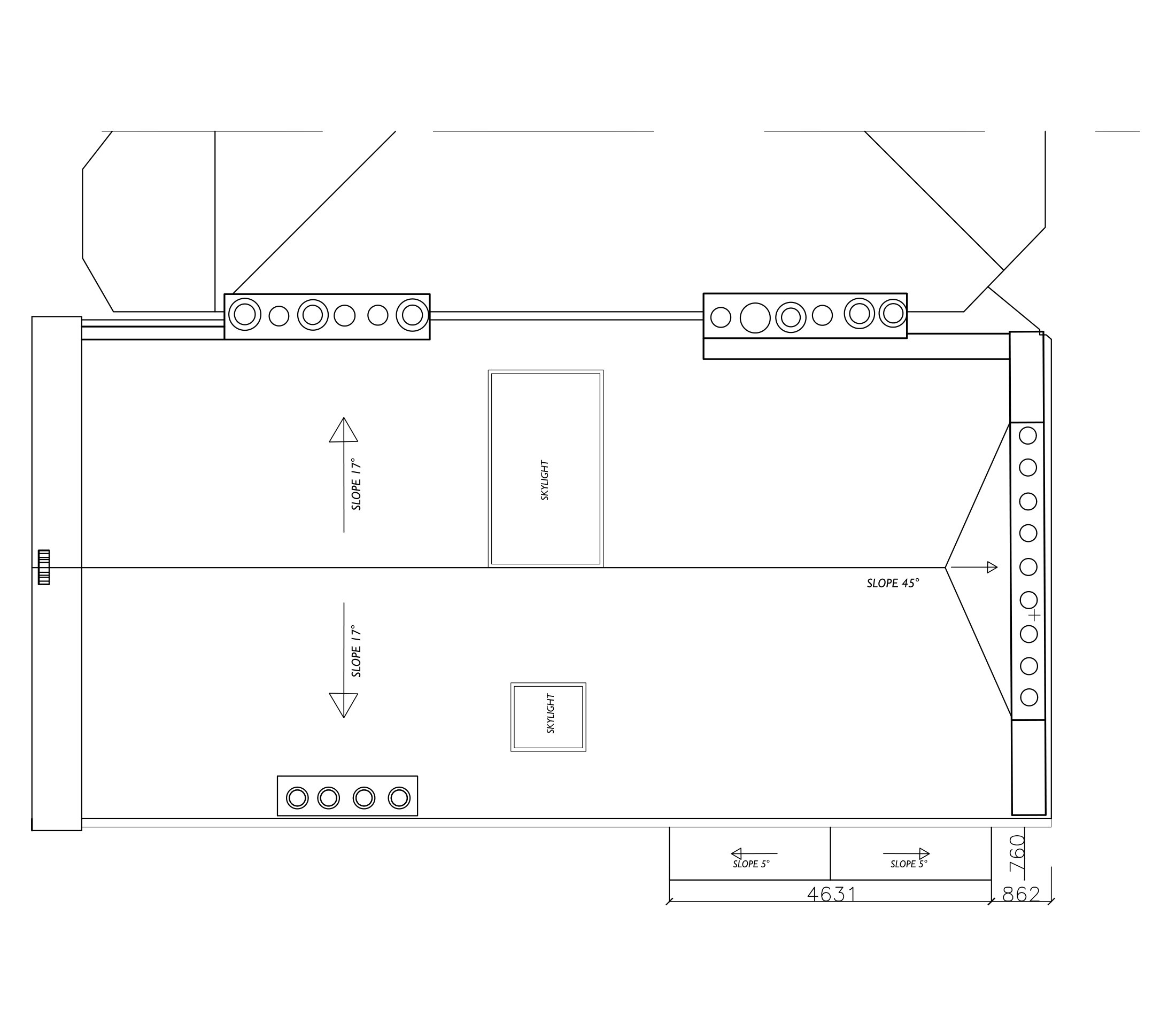
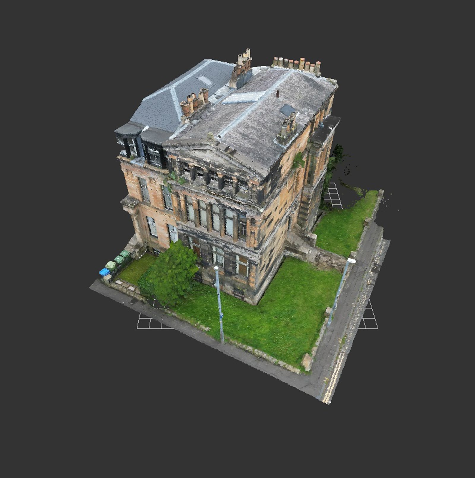
- Drone photogrammetry of the roof, producing the textured model at the top of this page and the geometry behind the roof plan — slopes, skylights, chimney heads and all.
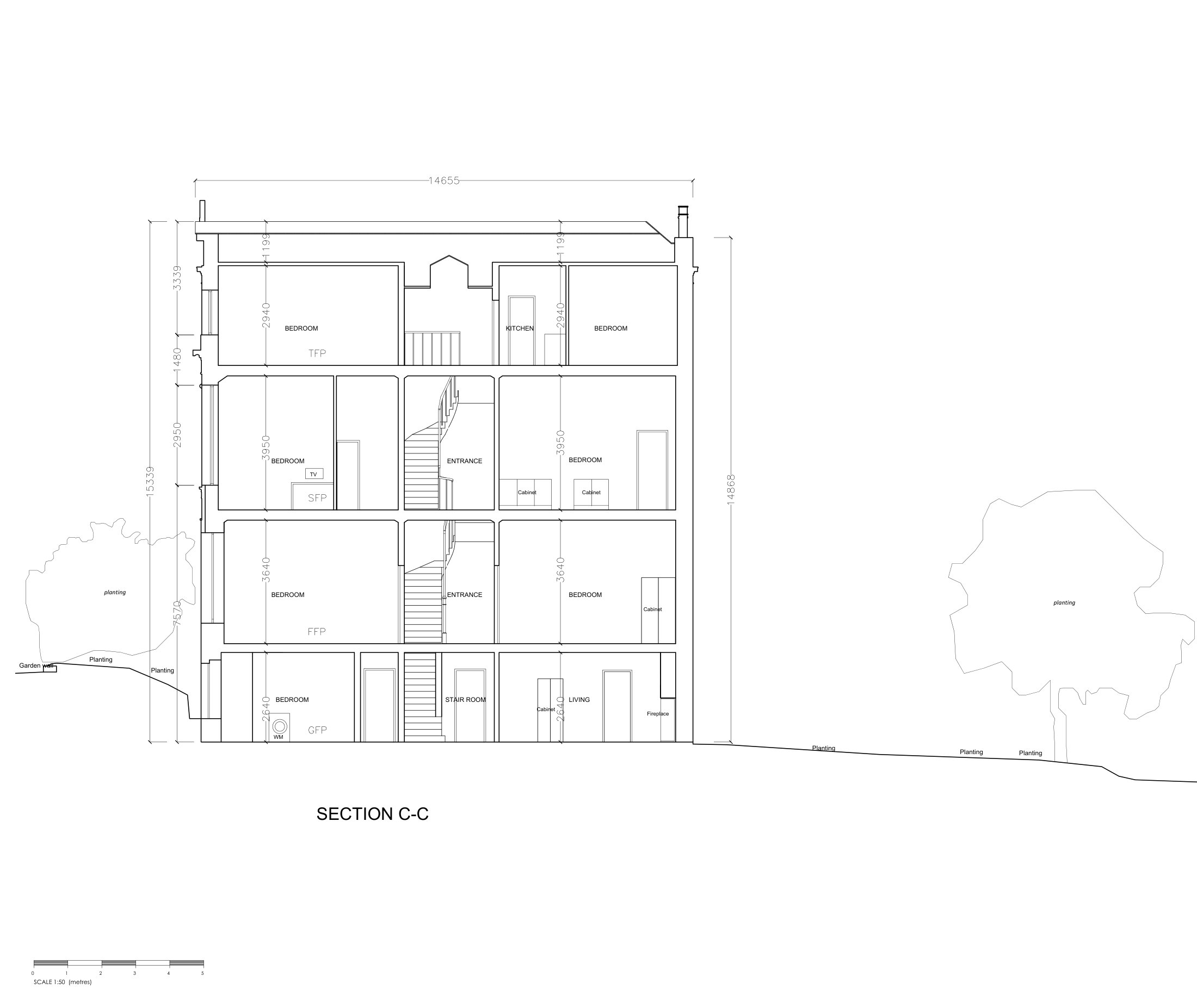
The drawings were produced in CAD directly from the point clouds — not traced from a sketch — and issued in DWG and PDF. Window head and sill heights, floor levels and ceiling heights are annotated on the plans and sections. A first issue went out within two weeks of the site visit; the architects’ comments were incorporated and the set re-issued two days later.
The Deliverables
Nine sheets at 1:50 in DWG and PDF:
- Existing floor plans — ground, first, second and third
- Existing front (south) elevation and both side elevations
- Three sections — one long, two cross — with floor-to-floor and ceiling heights
- Existing roof plan and site plan
The sheets below are the issued drawings with the title blocks removed. The point cloud itself was supplied alongside, so the design team can check any dimension that was not drawn without a second visit.
Why It Matters
This is the kind of building a tape measure gets wrong. The façade steps and the garden falls, the bays are not symmetrical, the floors differ in height, and the upper floor sits partly in the roof. Drawing from the scan means the base drawings carry all of that, so the proposals, the planning drawings and the building warrant drawings are developed against the building as it actually stands. See our measured building survey service and what we do across Glasgow.
The Drawing Set
Have a similar project?
Let's discuss how we can help capture or assess your building.