Digital Capture
The Victoria, Battlefield — Drone LiDAR Survey
The Building
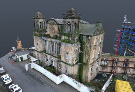
The Victoria in Battlefield is one of the Southside’s best-known landmarks — the ornate towered building that survives from the former Victoria Infirmary site. Standing derelict behind hoarding, with vegetation taking hold of the stonework, it presents the classic redevelopment problem: everyone needs accurate information about a building that nobody can safely walk through.
What We Did
We captured the building from the air using drone-mounted LiDAR, flying a planned coverage pattern around and above the structure. Aerial capture meant no one needed to enter or touch the building — no scaffolding, no rope access, no risk.
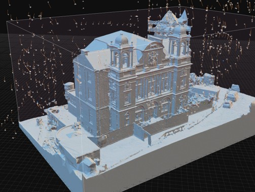
The result is a complete spatial record in two complementary forms: a colourised point cloud that preserves the building’s current condition — weathering, vegetation, losses and all — and a clean 3D mesh model of the geometry itself.
The Deliverables
- Colourised LiDAR point cloud of the building and immediate site context
- 3D mesh model generated from the scan data
- A permanent, dated record of the building’s condition
For buildings in this condition, the point cloud often becomes the single most-used project document — feasibility studies, condition assessments, and conservation discussions can all work from the same measurable dataset while the building stays safely sealed.
Have a similar project?
Let's discuss how we can help capture or assess your building.